

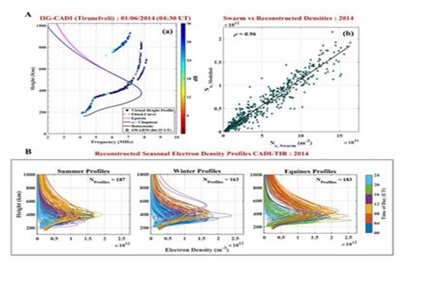
Indian researchers have developed a novel approach to reconstruct the topside ionosphere over the Indian region for the first time by integrating ground and space-based observations. This method creates a more accurate map of the upper ionosphere over India. It helps scientists better understand how this part of the atmosphere behaves and provides more precise estimates of how its density changes with height in the Indian region. The Ministry of Science and Technology said that this approach would be critical for satellite operations, communication systems, and navigation services.
The ionosphere is a complex, ionized part of Earth’s upper atmosphere that plays a vital role in atmospheric and ionospheric electrodynamical processes. The day-to-day variation in the electron density affects satellite-based navigation systems such as GPS or Indian NAVIC system by altering signal transmission. The improved reconstruction of the topside ionosphere provided by this method supports better understanding of the topside ionosphere and provides more accurate region-specific estimates of the topside scale height gradient. The Ministry said that this approach is particularly important over the geomagnetic equator, where ionospheric dynamics are highly complex due to the geometry of Earth’s magnetic field.